 |
|||||
|
Pokeka |
|||||
|
|||||
|
TRAMPERS
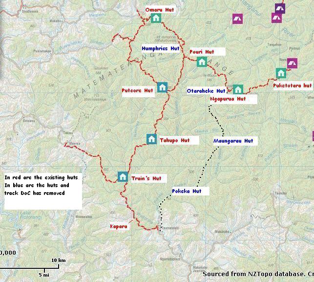
Humphries hut Maungarau Omaru river Otaraheke hut Pokeka Pokeka alternative route Puteore Tahupo Train's hut DAY TRIPPERS Kapara Mangawhio lakes Maumahaki reserve Ngamatapouri Pungarehu rapids Rotokohu wetlands Waitahinga trails Waitotara R.mouth Waverley inland Waverley beaches Weraweraonga
MAPS
|
This hut has now been removed by DoC despite the overwhelming public
demand to retain the hut in the recreation review. This was a great hut
to introduce newbies to our conservation estate. Unfortunately the local
DoC have a huge disinterest in this area, and do not comprehend that
many users of this public estate are happy to use the humble forestry
huts like Pokeka and Maungarau, and may even prefer them. This page, and pages of the other huts removed by DoC about
the same time, are being retained as one can dream that one day the
neglect of this area will cease.
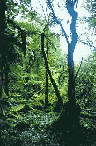
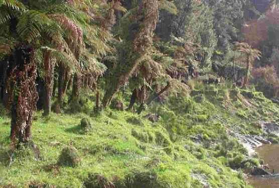
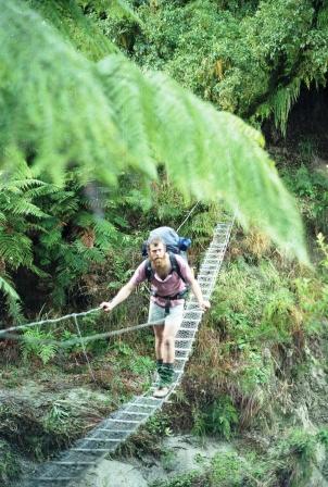
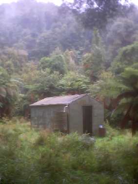
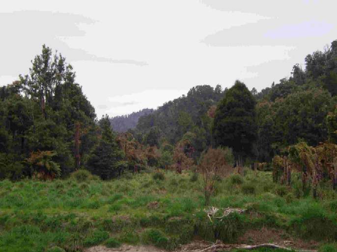
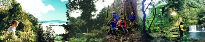
Walking in Pokeka track loosely follows the Pokeka stream through farmland and forest with the original destination, Pokeka hut, approximately 4 ½ hrs from the Waitotara valley road end. The forest section is valley forest with some grand trees on show. The hut nestled in a glade with a large Rimu just out from the door. The farmland section includes a walk through the Rotokohu wetlands which has survived the Feb 04 floods and is slowly reverting back to it's original glory of a lake and swamps framed by the forest of the Rotokohu scenic reserve. The hut was about 80 minutes beyond the end of the farmland but due to heavy stock grazing there is serious deforestation well into this public land. This has noticeably worsened in the last decade. There is much goat and deer damage and control is sorely needed. As access on the paper road through the farmland does not connect to the council bridge at the formed road end, permission is required and usually afforded to trampers but hunters are denied. There is an alternative for hunters but navigation skills are needed. (see Alternative access). The track is rated as "Back Country Adventurer" by DoC, no doubt reflecting it’s past popularity. It was proposed to be closed in the current recreation review but now has reverted to a "cease maintenance" track, a status it is well used to as neglect and lack of promotion are hallmarks of DoC’s 18 years of stewardship in the Waitotara’s.
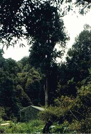
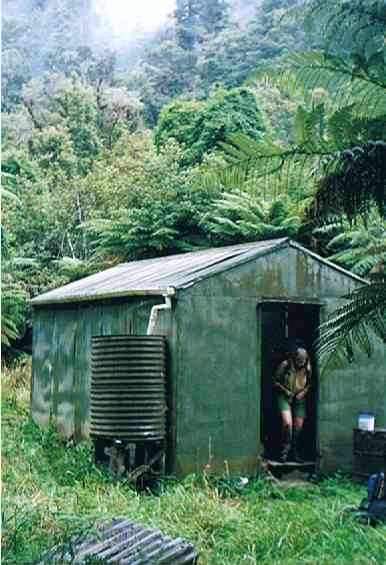
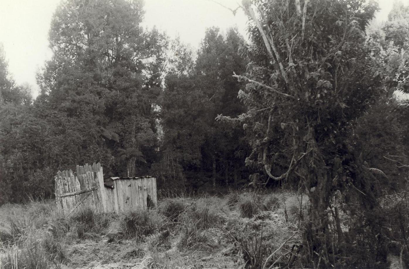
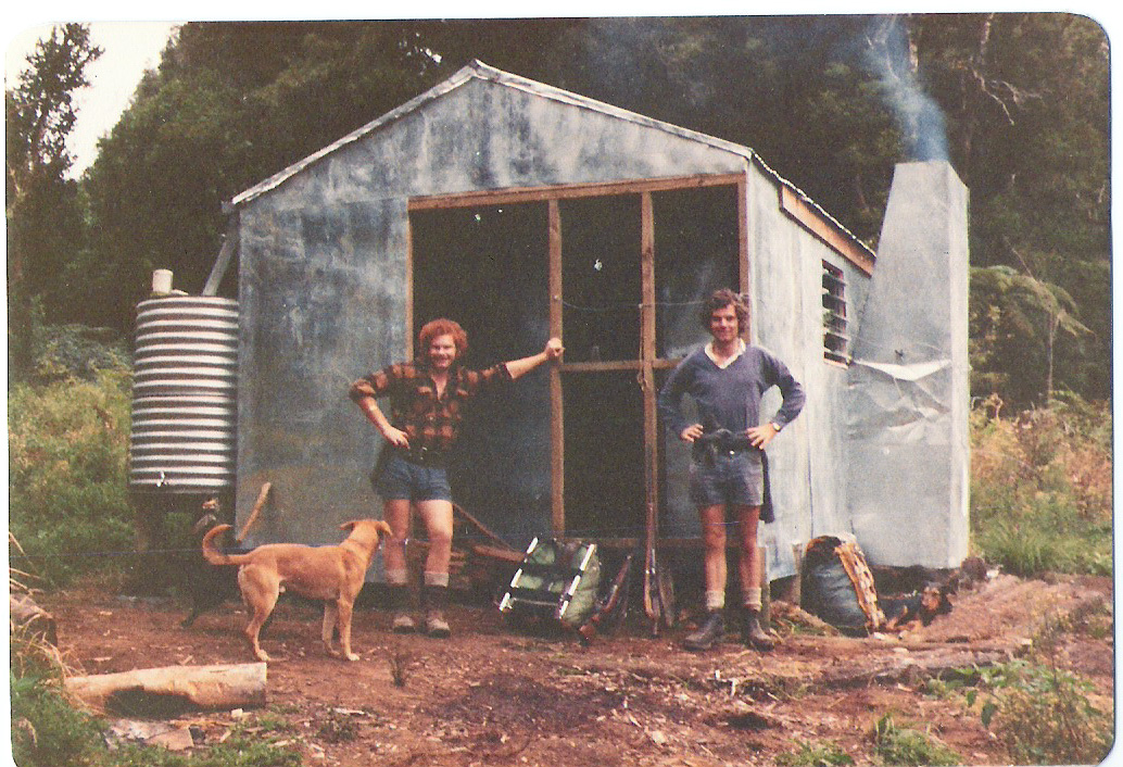
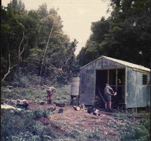
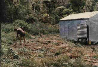
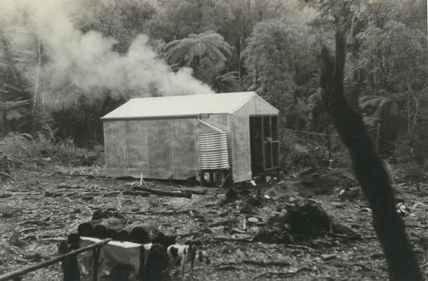
Pokeka hut While Pokeka hut was an excellent destination in itself it was also a necessary link in the eastern route through the Waitotara State Forest and the Southern Wanganui National Park to the Matemateaonga Walkway, two long days walk to the north. Maungarau was the next hut on this route, about 4½ hours away. But it too has been removed. This route, and it's two connecting links across to the western route, is what DoC proposed to remove in the recreation review but the fact that it represented 78% of the total national track closures gives an indication of how out of step Wanganui DoC is with the rest of the country. Due to the public outcry this route is now proposed "cease maintenance" which will save it in the short term. One of the highlights in the past of staying at Pokeka was the sound of numerous kiwi at night but unfortunately we have heard none in the last few visits. Hopefully the decline in numbers is not permanent; this was a stronghold for them. However the invasion of stock into this valley does not bode well for them. Day trips from the hut site include walking towards Maungarau as far as one feels. This is a ridge top walk which is a pleasant change from the valley walk in to the hut and the views out from the forested ridge give an indication of the scale of this forgotten land. Other walks can include exploring the Whakauahi Stream straight across the Pokeka stream from the hut or going further up the Pokeka beyond the hut site where there are some large bush covered river flats. Neither of these are marked tracks. The Pokeka stream is not bridged and despite it being only a small stream it rapidly becomes uncrossable in wet conditions. The hut was on the road end side of the stream, so escape home is hindered in the wet mainly by the crossing of the Tunapoto side stream where the farmland ends.
History of Pokeka hut
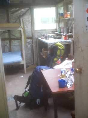
Pokeka hut was built in the 1970’s. It
was what was called a "FS70" type hut by DoC. Unlike the most of it’s myriad
of counterparts in other parts of the country it had not been upgraded to
a closed fireplace and still had the tin side chimney and open fire. It
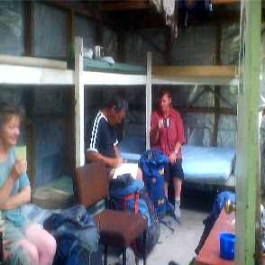
had six bunks and a full complement of somewhat scruffy but serviceable
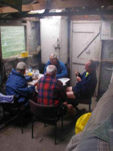
mattresses. It was a cosy hut that was usually kept tidy by it’s patrons.
DoC Whanganui called this hut dilapidated and did not charge a fee. In the mid to late
80’s, in the last years of the Forest Service the hut was painted, In the
mid 90’s some clear panels were inserted into the roof. Apart from this,
this hut had no maintenance what so ever. In early 2001 the Area
Manager and a staff member helicoptered to the hut and under the guise of
an inspection kicked a large hole in the middle of the floor presumably
with the intention of the hole condemning the hut. Fortunately a tramper
in the area identified them as the culprits and an apology and a hasty
repair was achieved. No holes appeared in the floor after that although it
was recognized that the chipboard did need replacing. This was the only
significant vandalism to the hut. In the entire 18 years of Doc existence
our hut had a maintenance history of total neglect and this is
perceived as the key driving force by the Department to remove it,
presumably to hide their gross incompetence. The four other FS70s in our
forest had the same neglect and have all been removed. This is in
stark contrast with matching huts in other conservancies, maintained,
loved, and
prospering.
DoC Wanganui determined that this hut should go and be replaced with
a totally inadequate shelter, specifically designed not to sleep in,
(no bunks and no fireplace) across the unbridged stream making it useless as an over night
destination. Such is the management and consultation skills of DoC
Wanganui.
One wonders why their own local
trampers miss out while the New Plymouth end of the conservancy got two
new huts in Tahupo and Puteore. |
||||