 |
||||||
|
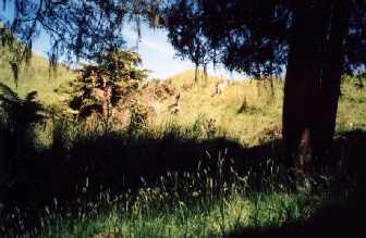
Pokeka alternative access |
||||||
|
||||||
|
TRAMPERS Humphries hut Maungarau Omaru river Otaraheke hut Pokeka Pokeka alternative route Puteore Tahupo Train's hut DAY TRIPPERS Kapara Mangawhio lakes Maumahaki reserve Ngamatapouri Pungarehu rapids Rotokohu wetlands Waitahinga trails Waitotara R.mouth Waverley inland Waverley beaches Weraweraonga
MAPS
|
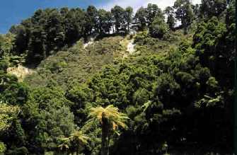
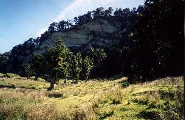
The track to Pokeka at present leaves the
end of the Waitotara valley road, and follows a paper road through
farmland to a forest boundary some 5 - 6 km away. Unfortunately the access
at the road end is controlled by the farmer who runs a tourist hunting
venture. Because of this he denies all access to hunters, and
denies access to trampers when he has "clients". Yet the DoC publication
giving the Recreation Opportunities Review decisions of this area state
that this "landowner has advised that existing access over his land
remains available" and give this as one reason for not relocating this
track to our Conservation estate adjacent. The other reason for not
relocating the track is that it "would be seen as provocative to the
adjacent landowner who has concerns about hunters trespassing / poaching
and stock disturbance." (p 36). DoC Wanganui acknowledges that this farmer grazes DoC land, including the ecologically valuable Rotokohu wetlands, with no licence. He has been allowed to farm deer on the boundary of a forest that, until recently, had not been invaded by this particular pest. Yet DoC don't want to provoke him by removing Pokeka track from his land (it is a public road!) and relocating it in adjacent DoC land!!! Here is a chance to have hunters control the deer that invade this part of the forest and DoC is not interested. One has to wonder what is going on here. Therefore it was perhaps not surprising that in the original Recreation
Opportunities proposals, DoC decided to close this track. With the huge
public submissions against this proposal though, the next decision was to
simply not maintain the track. (It hasn't been maintained for ages
anyway!) Because this was such a contentious issue, the final decision was
to seek community maintenance. Sounds fine. But newspaper articles since
the release of the final proposals have DoC Whanganui making it quite
clear that without community maintenance, the track AND Pokeka hut AND
Maungarau hut would go, and no shelters would be built to replace them.
The official DoC publication does not state this requirement for the huts.
Again, what is going on here?
See local maps link
Alternative proposal
for Pokeka / Trains / Pungarehu area
Access
proposal for the Pokeka track. All these activities and opportunities are endorsed and many are prioritised by the Wanganui Conservation Management Strategy and central policy as demonstrated by the sample of policy references presented.
We believe
the bridge site to be viable, no more of an engineering challenge than the
proposed Trains bridge.
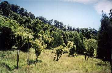
Approximately
2 km from the river is the Rotokohu wetlands which are a DoC " Recommended
area for Protection " (R.A.P) and are considered " Best example of poor
draining silt plains in the Matemateaonga Ecological District being
undrained with intact native vegetation." by the Taranaki Regional
Council. This would be a tremendous day tramp opportunity. This area would
have to be one of the most scenic areas in the Matemateaonga region. In
fact in 1881 one of the first surveyors in the area, George Allen
described it in a report on the district as one of the most beautiful
places he had seen.
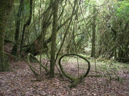
The Rotokohu
Scenic Reserve and associated wetland have had a long history of goat
depredation and this along with unlicensed grazing has created the
pastoral forest margin within the public estate. And now with a wild
population of fallow deer being actively encouraged in the area the
onslaught on the forest will only increase. Note that the C.M.S. Land
Inventory 70261, Rotokohu Scenic Reserve dated 1/06/94 does not mention
fallow deer as a pest. The newly established deer population requires
priority control. By merely supplying this bridged access a good level of
pest control would naturally be achieved.
This bridge along with
the Proposed Kurapete track are final links to complete what is already an
ideally integrated series of diverse opportunities that introduce and
transverse the Matemateoangas namely:
|
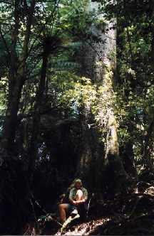 a decent sized kahikatea tree
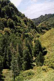 another view
|
||||